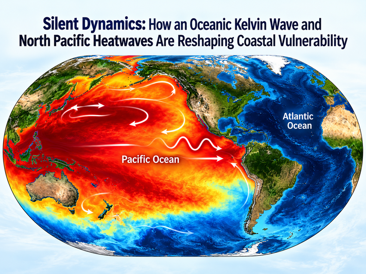
While atmospheric conditions over the tropical Atlantic have remained unusually quiescent, oceanographers and climate scientists are turning their attention toward a multi-phase oceanic disturbance unfolding in the Pacific Basin.
Monitoring systems operated by the National Oceanic and Atmospheric Administration (NOAA) and research institutes globally have detected a massive, slow-moving oceanic downwelling Kelvin wave propagating eastward along the equator. Rather than displaying the high-energy, sudden visual surface impact of a tsunami, Kelvin waves represent a gradual, planetary-scale redistribution of mass and thermal energy capable of temporarily elevating coastal sea levels and disrupting marine ecosystems across vast distances.
Mechanics of a Downwelling Kelvin Wave
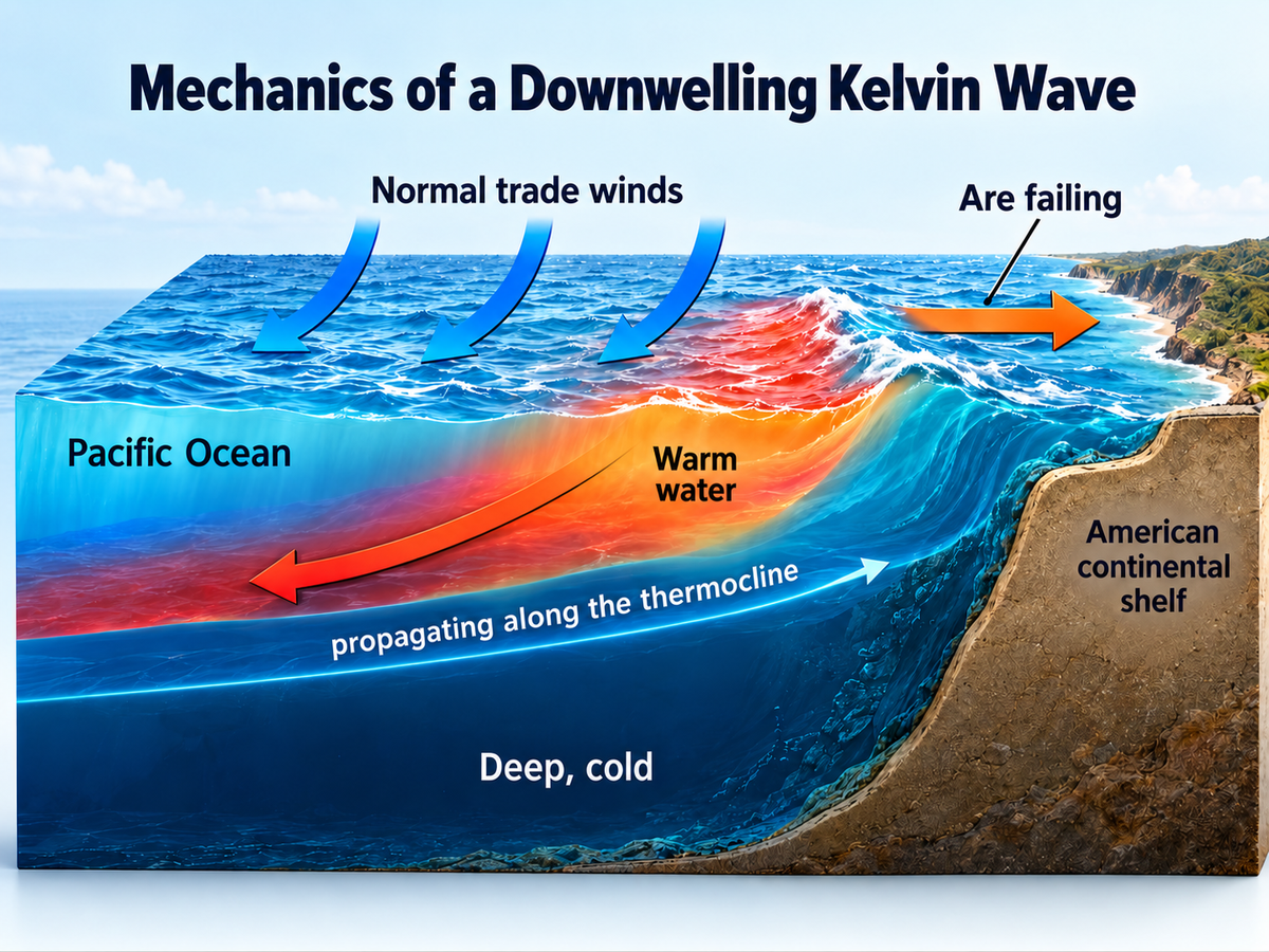
Oceanic Kelvin waves are non-linear, internal waves trapped along the equator by the Earth's rotation (the Coriolis effect). Under normal climatological conditions, strong westward trade winds push warm surface waters into the Western Pacific Warm Pool, depressing the thermocline—the density boundary separating warm, oxygen-rich surface waters from cold, nutrient-dense deep water.
When equatorial trade winds weaken or collapse, this accumulated warm water sloshes back toward the Americas.
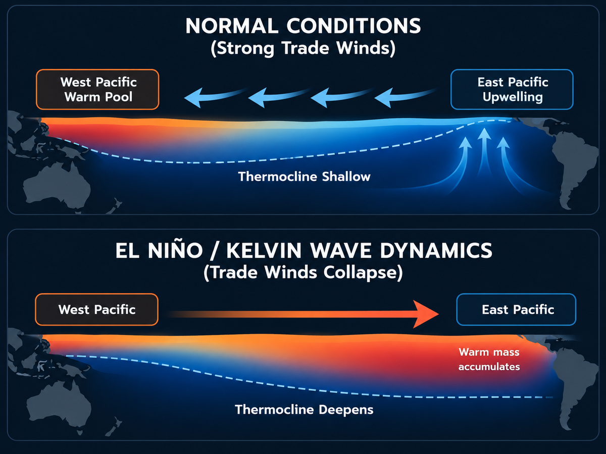
As the Kelvin wave hits the South American continental margin, it bifurcates, generating poleward coastal Kelvin waves that travel north toward California and south toward Chile.
The Dual Mechanics of Coastal Elevation
Unlike atmospheric storm surges, a downwelling Kelvin wave elevates localized coastal sea level through two distinct geophysical processes:
- Steric Expansion (Thermal Expansion): Warmer water is physically less dense than cooler water. As the wave pushes warm surface layers deeper, the expanding water column increases local sea surface height by several inches.
- Mass Accumulation: The physical movement of water against continental margins elevates the baseline sea level along coastal zones for weeks or months.
Marine Heatwaves and “The Blob”: Ecological Disruptions
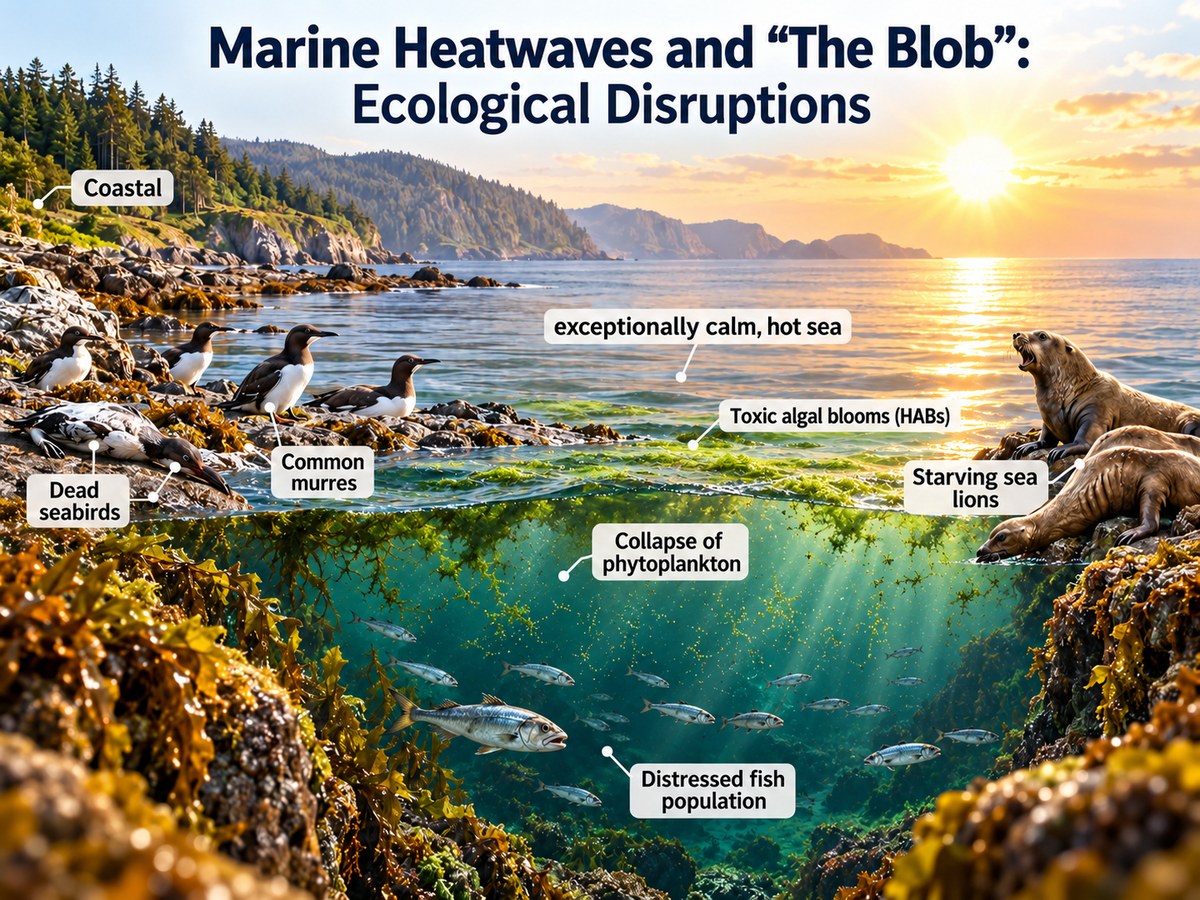
The current equatorial Kelvin wave interacts with another persistent oceanographic phenomenon: Marine Heatwaves (MHWs), often referred to as “Blobs”.
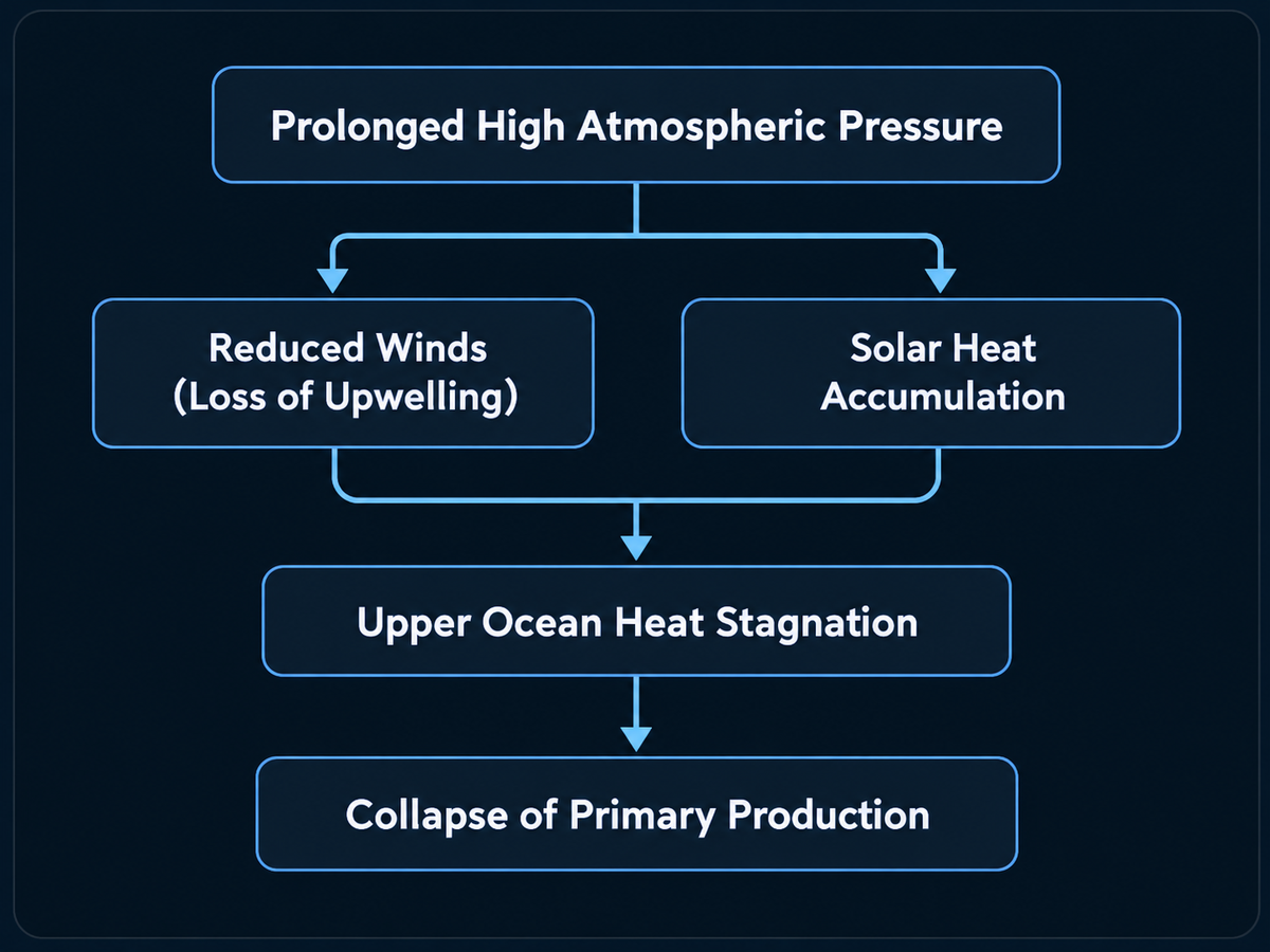
Thermodynamic Formation of Marine Heatwaves
- Atmospheric Stagnation: Persistent high-pressure systems park over the northeastern Pacific, weakening surface winds.
- Loss of Vertical Mixing: Reduced wind stress prevents colder, nutrient-dense deep water from mixing into the photic surface layer.
- Solar Energy Accumulation: Uninhibited solar radiation heats the surface layer, trapping thermal energy in the upper ocean for extended periods.
Trophic Collapse in Marine Ecosystems
When a Kelvin wave suppresses coastal upwelling in regions already experiencing marine heatwaves, the biological consequences are severe:
- Nutrient Depletion: Without nitrate and silicate flux from the deep ocean, primary productivity by microalgae and phytoplankton crashes.
- Food Web Failure: Primary consumers (zooplankton, forage fish) collapse or migrate, leading to starvation events among higher trophic predators, including marine mammals and seabirds (such as common murres).
- Harmful Algal Blooms (HABs): Exceptionally warm surface waters foster rapid toxic microalgal blooms, impacting coastal fisheries and shellfisheries.
The Pacific-Atlantic Teleconnection Paradox
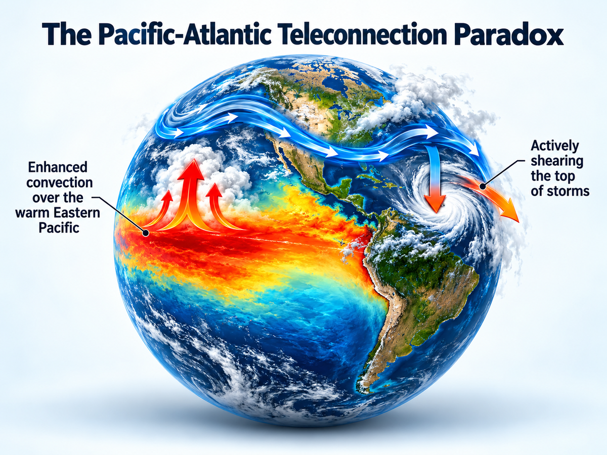
A striking feature of current global ocean dynamics is the stark contrast between Pacific instability and Atlantic tropical suppression. This divergence is driven by atmospheric teleconnections.
| Ocean Basin | Primary Ocean-Atmosphere State | Direct Impact on Storm Systems |
|---|---|---|
| Equatorial Pacific | Anomaly-driven warming & Kelvin wave propagation | Enhanced atmospheric convection, altered Walker Circulation, and intense precipitation |
| Tropical Atlantic | Increased tropospheric Vertical Wind Shear | Storm organization disrupted; tropical cyclones stripped of vertical structure |
When vast pools of warm water shift eastward in the equatorial Pacific, intense atmospheric convection shifts with them. This shift alters global wind patterns in the upper atmosphere, generating strong vertical wind shear across the Caribbean and main developmental regions of the tropical Atlantic.
This wind shear tilts and disrupts the vertical structure of developing tropical depressions, preventing them from intensifying into major hurricanes even when sea surface temperatures in the Atlantic remain warm.
Modern Earth System Observation & Prediction
Quantifying and forecasting these multi-faceted oceanic phenomena relies on an integrated global observing network:
- Satellite Altimetry: Precision radar measurements track changes in sea-surface height down to the millimeter, allowing climatologists to map Kelvin waves in real time across ocean basins.
- Moored Buoy Arrays (TAO/TRITON & Argo): Thousands of autonomous profiling floats continuously measure subsurface ocean temperature, salinity, and current velocity from the surface down to depths of 2,000 meters.
- Supercomputing & AI Climate Modeling: Advanced coupled ocean-atmosphere General Circulation Models (GCMs), accelerated by machine learning algorithms, process petabytes of real-time oceanic data to project coastal impacts months in advance.
Through these observational capabilities, climate scientists can provide early warnings to coastal emergency planners, port authorities, and commercial fisheries—allowing communities to mitigate the risks associated with temporary sea-level surges and marine ecosystem shifts before they hit.